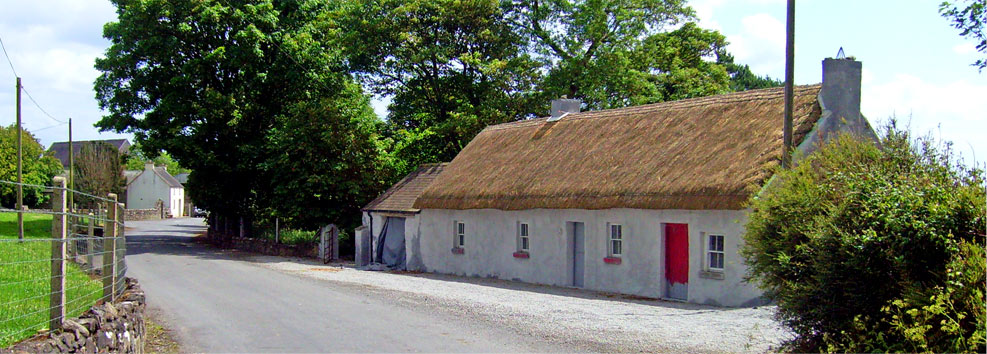
© Donal G. Burke 2019
Lissanacody is a townland in the parish of Donanaghta on the southern slope of Redmount Hill, near the village of Eyrecourt. A list of castles of County Galway, believed to date from about 1574, makes no reference to a castle at Lissanacody within the Barony of Longford (the O Madden’s ancestral territory of Síl Anmchadha). However, ‘Lisnacode’ is given as the residence of one Murrogh mcfferigh in the adjacent barony of Leitrim further south in County Galway. The reproducer of the 1574 list appears to have erroneously placed in the barony of Leitrim both ‘Lisnacode’ and ‘Cloghan’, two O Madden castles which should more correctly have been included within the barony of Longford.
The error may have occurred in confusing the townland of Lissenhackett in the barony of Leitrim with Lisanacody. Morogh mcRory of Lissenhackett was given as one of the chief men of the barony of Longford in 1585. Moraigh keigh mcFeary of Lisnackody, gentleman, received a pardon in the second year of the reign of King James I and was earlier described in a pardon of 1585 as Murcho mcFerriagh of Lyssenackett (Cal. Fiants, Eliz. I.) (In that same second year one Donnogh mcMoraghe of the same was also pardoned.) It is evident that this is the same man as Murrogh mcfferigh of Lisnacode of 1574 and so it would appear evident that the Morogh mcRory mentioned in the 1585 Indenture should correctly be Murrough mcFeary O Madden.
That Lissanacody was a castle or tower house as opposed to any other type of residence is evidenced by its inclusion as such in a legal transaction of 1670 involving John Eyre of Eyrecourt. Eyre had acquired extensive lands about east Galway in the 1650s following the Cromwellian transplantations. He erected a modern spacious mansion for himself and his posterity at Killenihy, to the east of Lissancody which became known as Eyrecourt Castle and about which a village soon developed. When Eyre came to draw up the document making provision for the future settlement of his property among his heirs in 1670 mention was made therein to ‘the castle, towne and lands of Lissenaccody’.[i] The denomination of Lissanacody did not appear among the lands in the barony of Longford confirmed in 1666 unto John Eyre under the Acts of Settlement and Explanation but ‘Lyssanacody alias Corballybegg’ was among a number of lands in the vicinity confirmed unto Erasmus Spelman in the same year. It appears therefore that between 1666 and 1670 Eyre acquired the same from Spelman. (NLI, Dublin, PP 941, Public Records Ireland, Reports, Fifteenth Annual Report, 1825, pp.79-80.)
At some stage what may have been a substantial or at least comfortable house was added to the castle. A deed of mortgage dated October 1710 involving the Eyre family made reference to ‘the castle with a good house thereunto adjoining called Lissnecoaddy and an orchard containing 2 quarters of land.’[ii] The house and lands were set by the Eyres to a family of the Donelans who resided there from the early 1700s up until about the 1770s when it passed through marriage to a Seymour family. In 1737 Colonel John Eyre of Eyrecourt leased to Charles Donelan of Lissenacody, gent. ‘the castle, town and lands of Lisenacody, Cloghbrack and Brideall (recte: Budellagh) containing as Stafford’s Survey 198 acres of land’, alongside other property.[iii] The Donelans remained at Lissanacody into the eighteenth century until, following the 1773 marriage of Hannah, daughter of Charles Donelan the younger to Richard Eyre Seymour the property passed to the Seymour family who were seated there in the early nineteenth century. John O Donovan’s Field Name Books, related to the Ordnance Survey of 1838, described Lissanacody in August of that year as containing ‘a gentleman’s seat called Lisinacody House, several farm houses, a smithy, two Danish forts and a number of wells’. However, by about 1855, the land had been acquired by Allan Pollock of Lismanny and the house became a steward’s house.
The location of Donelan’s house with the attached remains of the castle is likely to have been that house simply identified on the 1838 Ordnance Survey maps as ‘Lissanacody’ within the townland of that name. No mention is made to the ruins of a castle on the map and neither is any reference made to a castle therein in the contemporary Ordnance Survey Letters relating to the parish. No obvious trace of the castle remains on site and no knowledge of any castle at Lissanacody survived in the collective local memory by the early twenty-first century.

